-40%
Map CELTIC EUROPE Ireland Scotland Wales Gaul Brittany Tribes Halloween Culture
$ 4.21
- Description
- Size Guide
Description
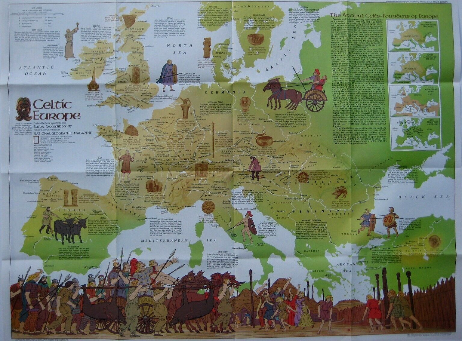
Beautiful fold-out map locating the various tribes of the ancient Celts, founders of Europe.The map opens to 22½" x 30" and identifies areas of Celtic civilization from the Iberian peninsula to Asia Minor and north to Scandinavia and the British Isles, with many ancient place names.
Among the tribes labeled are the Atrebates, Caletes, Veneti, Lemovices, Ligures, Senones, Taurisci, Cotini, Dardani, Tectosages, Caledones, Ordovices, Parisi, Vindelici, Boii, Helvetii, and many more.
In the second century B.C., Gaul alone boasted more than 60 tribes and was the center of late Celtic culture in Europe.
Illustrations and descriptive text provide a fascinating history of the Celtic peoples and the persistence of Celtic culture in traditions such as Halloween, lively folklore, and ancient languages still spoken today by two million people in Wales, Scotland, Ireland, and Brittany.
On the reverse side there is a full-color political map of Europe, including Spain, Portugal, Italy, Greece, Bulgaria, Romania, Hungary, Yugoslavia, Austria, Switzerland, France, Germany, Czechoslovakia, Belgium, the Netherlands, Luxembourg, Denmark, Poland, Ireland, Scotland, Wales, England, Norway, Sweden, Finland, and parts of Russia, Turkey, and the northern Africa nations of Morocco, Algeria, Tunisia, Libya, and Egypt.
Condition:
This map is in very good condition, bright and clean, with
no
marks or writing. Please see the scans and feel free to ask any questions.
This handsome map was published by the National Geographic Society in May 1977. It's a valuable reference and would make an attractive display.
Buy with confidence! We are always happy to combine shipping on the purchase of multiple items — just make sure to pay for everything at one time, not individually.
Powered by SixBit's eCommerce Solution
